Helgoland, an island
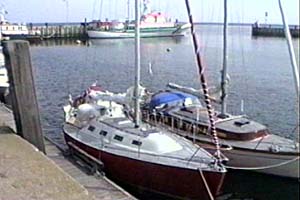
| Wife #2, Mogador, in the harbour of Helgoland - not Dune, which is forbidden for yachts. The first time I was in Helgoland was in 1976. We sailed directly from Belgium, and intended to reach the Elbe river to take the Kiel canal. But the weather got nasty and I feared entering the estuary on a gale wind against the ebb of the river. So, we made for Helgoland, a safe harbour in any weather. |
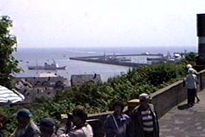
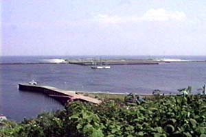
| The harbour, seen from the "upper town." You can also see a ferry anchored in the sound. Apart from tourism, the island has a few fishermen, mostly laying lobster pots on the shallow sandbanks around the island. This is a no-entry area and offenders face hefty fines! |
|
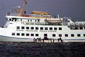
This is one of the many ferries coming daily to the island, from various places in Germany. They are not allowed to come alongside the quays, so they anchor in the sound between Helgoland and Dune, and carry passengers to land aboard large launches. In the middle-age, Helgoland - then called "Helige Land" (Holy Land) - was still one with Dune. The sound came later, as the land in this part of the world is sinking. |
|
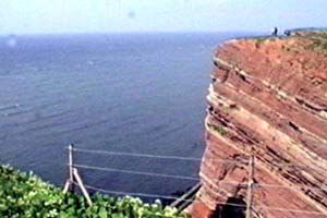
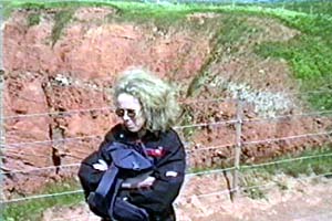
This are the famous red cliffs of Helgoland. The feature is quite unique as the island is in the middle of the German Bight and surrounded by extremely flat land and shallow waters. In order to preserve the cliffs from erosion and keep the sound from silting, several training walls are bordering the island. These "train" the water moved by the tidal current, to rest the sand on one of its side, and keep the other as deep water. They are to be found in many places on the Frisian islands and the bordering coast. |
|
Wife #1, Britt, on a tour along the cliffs. Tourists coming from yachts or ferries are first walking through the "lower town," mostly duty-free shops - the main income of the island - then they take the lift or the stairs to the "upper town" and walk all the way to the cliffs. Helgoland was British until about 1870, when it was traded against Zanzibar. In 1946 (or 47) the Allied placed on the island all the ammunition left from the war and blew the entire thing. Of course, the islanders were first evacuated. But there was not one single house left. All the buildings found on the island are from a later date. |
|
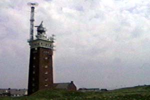
This is Helgoland lighthouse. It is very powerfull and it has also a lot of other radio devices, like the VHF direction finder antenna you can see on the top. Helgoland has also a SAR base with rescue helicopter, at its south end, near the harbour, and next to the hospital. The area has much maritime traffic as it is close to Hamburg, Bremmen, and the Danish coast. It is an ideal location for a Search-And-Rescue base. |
| This is the island of Dune (where the airport is) as seen from half way up to the cliffs. Dune is only accessible from the small ferry crossing the sound. It has beautiful beaches but no hotels. It is a daytrip place, and ... a nudist place. Unless of course, if you want to fly a plane. Then you are asked to wear clothes! |
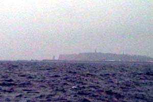
| Leaving Helgoland for Borkum, on the Dutch border. This was in 1998, on our way to England. The weather was misty and the picture is not that good. In fact these are not real pictures but digital grabbing of a video film I made of the trip. At work, we have tools to make digital movies since we produce multi-media maritime training CDs. |